Saturday 26 December 2009

Foremarke Circular


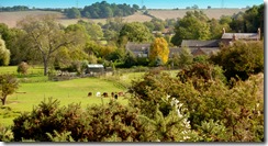
View from Fairview Farm, Foremarke
Here's a new walk which I have just written up. I have done it three times over the past 2 years and still enjoy it - especially in the fine crispy weather just before Christmas Day.
There are various other versions of this walk including one by peahen (see her blog right). She starts from the Reservoir Car Park but being someone who can't stand paying parking fees and also wanting a public transport link, I have started this near Coal Lane.
---------------------------------------------------------------------------

Start: SK334220
Route: Coal Lane – Foremarke Reservoir – Repton Shrubs – FairviewMilton Road – Foremarke Reservoir – Coal Lane
Distance: 8.3 km
Terrain: easy.
Park the car at the “lay by” at the junction with Coal Lane on the A514 near Hartshorne.
The Derby to Swadlincote bus also stops here. Cross the main road and take the restricted byway to Buildings Farm. After 200 metres you will find a gap in the fence on your right. (It’s the second gap in this fence).
Follow this path straight ahead (do not veer off to the left). The path dips down into a small valley descending to the left. Take the pronounced path in front of you which runs to the right of a small ride of trees that follow a stream. The path leads into a large open field. Look out for a gap in the opposite hedge. The track leads down to a foot bridge and boardwalk. (Carver Rocks is to your right and is worth an investigation). Follow the boardwalk to your right. Before long you will reach the south end of the reservoir and another bridge. Cross the bridge and follow some steps up hill through woodland.
Bottom of Foremarke reservoir
After 100 metres watch out for a path on your right that leads down to another foot bridge. From the bridge the path leads up to a notice board about Carver Rocks and a stile. The path leaves the wooded area and climbs almost straight ahead (slight left) to a stile at the top of the field. Here you meet a racing horse training track and pass through a small hinged gate. The path from here heads towards a small wood in front of you; aim to the right of it. You cross the race track again and follow a path with a wooden fence on your right. The fence separates you from the any race horses that might be training. After crossing a field you hit a metalled road where you turn right.
View towards Willington
Walk past the Bondwood farm drive on your right and a large communications pylon on your left until you reach a gate at the point where the track starts to descend towards Repton. Do not follow this route but take the track on your right. The views over the Trent Valley at this point can be quite splendid. Just before Fairview farm take the bridleway on your left, heading downhill towards the reservoir. The track descends very pleasantly through open country. After 800 metres it starts to sink and become tree lined. Soon you reach a metal farm gate and some properties on your left. On reaching the Ticknall to Milton road, turn right. There is now 1.2 kilometres of road walking but the road is generally not too busy and after 5 minutes you can walk on the wide verge on the left. Ignore the turn to the Burton Sailing Club. It’s the next main track on the right that you want.
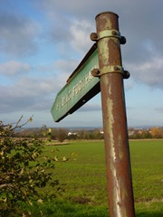
Sign near Brookdale sign
Enter the Reservoir area just beyond Bendalls Farm. To avoid the traffic you will find a path that runs parallel to the road on the left. The path soon reaches a wide gate which leads down the cycle path. Follow this very enjoyable undulating track for 2 kilometres. There are good views over the reservoir on your right.
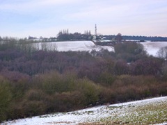
Looking back to Repton Shrubs
The track eventually meets a “T” junction where you turn left. Follow the road around to your right to a set of gates on the Ticknall to Hartshorne road where you will probably find some cars parked. You should see your car (or bus stop) from here on the left downhill several 300 metres ahead.

Monday 14 December 2009

Royal Label Factory


I spotted this makers' name on the footpath sign opposite the Sir Frances Burdett B and B on Derby Road (click to enlarge).

It seems that the company originated in Stratford upon Avon, then moved to Chipping Norton. It is now located just outside Buxton at Dove Holes!

It received its royal warrant in 1876 when it made metal plant labels for Queen Victoria.

The company is now owned by Leander Architectural (since 1998).

I found an interesting article here.

Saturday 12 December 2009

Curious signs on Melbourne FP6

Double FP signs

Melbourne FP6 runs from Cockshut Lane to Derby Road opposite the old Sir Frances Burdett PH.

It makes a useful short cut avoiding a sharp bend in the road.
You can link it with Breach Lane, Poppy Wood and the St. Brides Bridleway to make a return stroll to Melbourne.

Half way across is this curious double sign erected, I guess, in the 1960s when the local Parish Council asked for intermediate signing along the route. It is by the small footbridge.

When I walked it this week the middle section of the path was very wet due to a month of rain.

Beyond this sign the route can be unclear, you have to make for the white Frances Burdett building.

From Cockshut Lane
Looking towards the Sir Frances Burdett from Cockshut Lane (distant white building on left).


Friday 11 December 2009

Robin Wood - Misleading Sign


I was very confused by this new sign whilst walking around the wood yesterday as a bridleway goes straight through the middle of the wood and a footpath along one side.

I have spoken to Alan Dowell of the Forestry Commission today who has agreed that the sign is confusing. He is going to add a new section to the sign pointing out that the ROWs are still open.


The Ingleby/Stanton Bridleway is to the right of the sign!

Saturday 5 December 2009

Smisby to Hartshorne circular - new walk

Harthorne from Several Woods Farm

Above: Harsthorne Church from Several Woods Farm, Smisby.
This must be almost the highest point in the District.
Best seen large - click on photo.

Route: Smisby - Several Woods - Hartshorne - Limehouse Dam - Daniel Hayes - Forties Lane - Smisby.
Distance: about 8 km. Terrain is easy.
Transport: Regular bus through Hartshorne - so walk could start there.

This walk was quite a discovery because it is very rural yet close to both Ashby and Woodville. In places the drone of roads was completely absent, something that seems to be increasingly difficult to avoid in South Derbyshire. It's also a good walk, in my opinion, because there is a pub at either end!

I started off in Smisby and took the path by the church. The path runs around the back of the church and squeezes by a house on its left. The stile into a large field has no marker and for a moment I was disorientated. You need to turn left here and follow the field edge around the corner. You need to be walking parallel to Forties Lane after a couple of minutes. The path is OK in the first field but missing in the next. Cross Heath Lane and into a small thicket. Walk over a drive and then follow the path through a few fields. This was clearly marked. Everything is fine until you come close to Several Woods Farm where a marker seems to point you north when you need to go west around the edge of the farm complex.

If you have managed to circumnavigate the farm you'll come to a notice board. From here take the track downhill. This soon goes through a small wood past a pool. Take the main track north west for about a kilometre. You eventually emerge on Manchester Lane, turn right and you come to the Bulls Head where I had a very good pint of Pedigree (they don't sell crisps!).

Bulls Head Hartshorne

I wanted to look at the church so walked downhill to Church Street. After the church a path can be seen on your right, take this uphill past a couple of bungalows. The stile in the fence was missing, clamber over it and at the next stile turn left. The route is now straightforward as you pass around Limehouse Dam and make for Daniel Hayes. When you reach a turnstile gate turn right (though if you turn right you can still get back around to Smisby by a longer route). The path is now along a low escarpment until it enters Sharp's Bottom wood. This section is very well marked for South Derbyshire. Eventually the path climbs quite steeply, keep straight ahead ignoring a track on your left. At the top just before emerging from the wood you can turn left by a sign warning about race horses or go straight on.

I went left and passed by some uninspiring forestry plantings on my left. At the end of this section you need to make your way around a large shed on your left. I didn't, ending up walking through the Calke Abbey Racing Stables. Nobody seemed to bother. I should have come out opposite Forties Lane which I took back to Smisby.

About 3 hours, slow walking with a drink in Hartshorne.


Tuesday 1 December 2009

Coast access bill becomes law!


I have been away for a few weeks but on return was cheered by the fact that the Marine and Coastal Access Act has come into existence (12 November 2009).

I know that Melbourne is about as far from the sea as you can get but like many walkers coastal walking is one of my favourite activities when I get the opportunity.

I am looking forward to accessing some of those bits of coastline we haven't been able to get to before.

(Photo from Defra website)


Tuesday 3 November 2009

New barrier on Melbourne FP 12

mp12 motorbike barrier
I was pleased to see that a new barrier has appeared on the bridge over the Carr Brook close to the Station Road end of Melbourne FP12.
I am guessing that this is to stop illegal motorcycling on the footpath.
DCC has done a nice job and deserves to be congratulated.

Saturday 31 October 2009

Melbourne to Donington walk

Walking group
Click on image to enlarge

Today a group of walkers from Melbourne Civic Society walked to Castle Donington (along Melbourne FP 20 and Castle Donington L87) to check the condition of the paths and test routes through Isley Walton, Langley Priory, Tonge and Wilson. Part of the Castle Donington leg had been closed last year for 6 months at the behest of Donington Park Racecourse.

The weather stayed fine with the odd glimpse of sun. They had a short break in Donington before walking up towards the airport and Isley Walton. The path from Langley Priory to Tonge was challenging as a section had been ploughed up and another area was heavily cropped with no clear right of way.

The group really enjoyed the walk (over 10 miles) but were quite tired by the time they returned to Melbourne!

Friday 30 October 2009

New walk - Melbourne to Donington and back.


Route: Melbourne – Donington Park - Castle Donington – Isley Walton – Langley Priory - Tonge – Wilson – Melbourne

Start: Castle St by the White Swan PH – Parking spaces here.
Refreshments: Castle Donington and Wilson.
Distance: 17 km. Moderate – mostly flat but a long walk including some pavement work.

Walk along Castle St to the Washpit, turn right down Station Road.
Pass by the new housing estate and Paddock Hotel (formerly The Railway Inn). Cross over the railway bridge and walk on the grass verge past Station Farm. There are two concrete remnants of the Melbourne Military Railway (1939-1945) in a field on your left. Cross the “New” Bridge and walk uphill. Watch out for traffic.
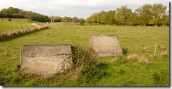
Military Railway
Melbourne Military Railway
At Ramsley House on your left take the signed path by the side of a yew hedge. Follow the path by the side of the house until you enter a large field. Walk along the field edge until you reach your first substantial tree/shrub and turn 90 degrees right. If you have reached a pylon you have gone too far. There is a good panorama of Melbourne and Kings Newton at this spot.
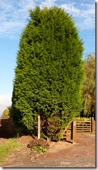
Ramsley House
Ramsley House
Viewpoint
Vista of Melbourne and Kings Newton
Walk towards a large solitary tree the remains of a hedge can be seen at ground level. There should be a gap in the hedge in front of you but this is sometimes overgrown. You need to find a way into this field so that you have the hedge on your left, the field on your right and the road further to your right. Having managed this soon you will see Melbourne View Hotel on your right on the main Melbourne to Isley Walton road. There is also a nice view of Breedon Church to your right.
The path goes through several fields with the hedge still on your left. You will cross a small footbridge (with a marker upon it) and squeeze through a gap in a hedge. Ramsley Wood appears on your left along with a barn building in the middle distance left at Newtons Corner. After you cross a track, walk alongside a row of telephone poles. In the corner of a thicket, ahead of you partly to the left, you’ll spot a Leicestershire yellow footpath marker. The path winds its way through a small scruffy thicket until it reaches a tarmac area. Follow the clearly marked path uphill between a wire fence and crush barrier. Turn left at the top where the rest of the route is obvious taking you round a large parking space used for the Sunday Market.
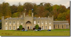
Donington Hall
Donington Hall
In the far corner of the car park the path begins to pass between a fence and the concrete security wall of Donington Park. This section can be a bit muddy. Where the path descends there are good views left of Donington Hall. The path begins to climb and leaves the concrete wall as it turns to the left. It enters a large pleasant grassy field which must have been landscaped by the Donington Estate. Keep the small wood to your right and follow the way around to Gate 6 of the Race Course where there is a good view of the track.
Climb a curious metal stile and turn immediately left along a wide rutted track. The countryside starts to open out. You cross a another track and can see the spire of Castle Donington church (St Edward) and the towers of Ratcliffe on Soar Power Station in front of you. Continue straight ahead, soon you will see the yellow footpath marker at the start of Dalby’s Covert. Follow the narrow track through this which can be muddy in wet weather.
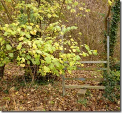
Curious stile
Curious metal stile
Exit the Covert by another curious metal stile and head in the direction of Castle Donington, where houses start to appear in the distance. Cross a footbridge and pass through several fields until you reach a children’s playground. Exit by a gate into a small housing estate. Turn right along Bosworth Road then left into Shields Crescent. Next turn right into Park Avenue and then left into Shields Crescent again. You eventually come to the main road Kings Mills-Donington road (Park Lane). Turn right here and eventually you come to traffic lights after passing some interesting old houses. If you wish to visit Castle Donington shops/restaurants take the road by the Turks Head PH which is Market St. where there are many local amenities. The church yard is a pleasant place to eat your sandwiches.
The walk resumes by climbing Main St towards East Midlands airport. Once again there are many interesting houses and structures on this route with large gardens. On your right do not miss the recently refurbished Long Wells.
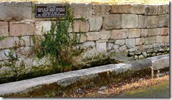
Long wells
Long Wells, Castle Donington
The path gets steeper towards the Nags Head PH but flattens out as you approach the roundabout by the Aero Park. Cross the road at this roundabout to reach a safe metalled pavement. You have about a kilometre of wind-swept walking here that takes you around the airport perimeter. Look out for an old metal milestone cast in Coalville with a curious spelling of the town.
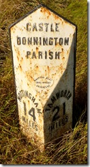
Milepost
When you see a bus stop on your left cross the road. A few metres on is a track through a hedge on your left. Ignore the sign pointing right for the airport trail and head straight on along the track between two airport car parks. Make for the main road over a track, stiles and a footbridge. Cross the very busy road to a stile ahead of you to the right of the roundabout. The path turns sharp left, crosses a closed and gated metalled road and enters another field by a footbridge where you turn right. You are now on a path that skirts two reservoirs on your left. Soon you are in open countryside and the path climbs uphill slightly to your left (there is a marker). At the top, pass a solitary tree and enjoy the views of Charnwood Forest ahead of you. Cross an open field to a hedge which you keep on your right until you spot a stile in the corner.
After passing a short and lovely hedge of oaks the well marked path goes through several fields until you reach a farm road coming up from Woodhouse Farm (Diseworth) which is on your left. Cross the road and make for another solitary oak tree. You are now in a very large field where navigation is difficult. You need to make a diagonal for the distant hedge on your right. The marker is well to the right of the barn conversion in the far distance. The path you want is roughly in the direction Smooth Coppice which is also on your right. If you get really stuck comb that hedge until you find the yellow marker. If you reach the barn conversion at the entrance to Langley Priory you have gone too far!
The path now cuts the corner of a field and crosses the main drive to ancient Langley Priory (private). Your next maker is ahead of you to the right of a telephone pole in the distance. Cross the stile there and skirt around a pond and the garden of Windyridge. The next post shows two footpath routes. Please make sure you take the right fork. If the route is not clear keep the right hand hedge parallel to your route. When Breedon Priory Church comes into view make for it. At the bottom of the field you will see a yellow marker. The path leads through another field then gently down to a main road. Cross it carefully and follow the well marked route through several fields one of which has humps and bumps and a concrete slab bridge. After passing around the back of the cottage “Church View” cross a minor road and take the path that leads you down to the railway where you turn right.
Sustrans
Walk along the disused railway track for 1.6 km until you reach a footpath sign for a path on your left. Make your way into Wilson and walk up Short Hill. Turn left for the Bulls Head PH for refreshment or straight ahead. Just past the South Derbyshire sign look out for a track that runs parallel to the road. This is part of the old Melbourne Hall Park carriage route. Keep on this track for half a kilometre until you reach an electricity pylon then rejoin the road down a short track.
Statue on Sustrans Cycle Path


Continuing towards Melbourne on the road watch out for a metal footpath marker on your right. This is Melbourne footpath 12 which crosses a large field to Station Road. If the route is not clear head for the small farm building in the middle of this field and then make for the houses on Station Road. You will need to find a wooden bridge that crosses the Carr Brook. The path climbs up to the road by the last house in Railway Terrace.
Turn left here and soon you will reach the Washpit that you passed at the start of this walk.
Sunday 11 October 2009

Why are there so few footpaths around Wilson?


Wilson, Leicestershire, is a small place about a mile from Melbourne (with a nice pub) but when you compare the two places Wilson comes off very poorly for footpaths.

However when you look at the old maps you can see that Wilson had a lot more in the past. Some today lead nowhere like the one heading past the mill.

Why did so few paths reach the Definitive Map?
Even tiny Isley Walton has more paths than Wilson.

Saturday 10 October 2009

Problems close to home!

It's amazing that you can walk over large areas of South Derbyshire rechecking the condition of paths for "Walks around Melbourne" then miss completely problems on your doorstep.

Two of these have arisen this week and both have been flagged up by other walkers as well.

1. The footpath sign on the path opposite the closed Sir Francis Burdett has gone. I think it was one of the nice old metal types like the one at the Cockshut Lane end. When I checked out the route, that looked pretty poor as well.

2. The footpath from Derby Rd to Main St Kings Newton (near the main turn to the town - see below) is also missing.


I have reported these to Derbyshire County Council using "Fixmystreet". It will be interesting to see how long it takes to get these fixed. I am not using the Derbyshire report form as in the past it has not submitted properly and all the entered data has been lost. This can be very frustrating!

Tuesday 29 September 2009

Anchor Church Circular

Route: Foremarke Hall drive (park on the verge by HGV entrance) - Anchor Church - Ingleby - John Thompson Inn - Ingleby to Foremarke Rd path (the "blue gates" path) - bit of road walking back.

This includes part of walk 8 in "Walks around Melbourne".

Anchor Church - beautiful setting
A lovely autumn day tempted me to revisit Anchor Church at Ingleby and I was not disappointed. I parked on the wide verge by the HGV entrance to Repton Prep school at Foremarke. Ignore the path opposite and head along the road to Ticknall. After a 100 metres take a path on your left which crosses a field to some metal structures by the side of the track. The path now heads straight ahead towards Anchor Church with a cliff face on your right. Over a curious metal stile and you have reached the intriguing caves which contain the Anchor Church. A steep climb up from the caves takes you to a great view of the ox-bowed Trent. Soon you spot Barrow-on-Trent church on the left bank and then the hamlet of Ingleby ahead.


Metal stile leading to Anchor Church caves
Look out for the llama farm and then follow the road (left) into Ingleby. Lots of recent building here with many barn conversions.
P1010048
Ingleby hamlet with llama farm in foreground
Make sure you see the village well cut into a small cliff opposite Well cottage.

P1010062
The well at Ingleby
The only problem on the walk so far was spotted in the field, on the right, leading to Ingleby Toft just short of the John Thompson (not on this walk). The farmer here usually doesn't bother to return the path after ploughing without pressure.
After refreshment in the excellent John Thompson Inn retrace your steps to the footpath that came down from the ridge above the Anchor Church. At the top of the first field take the left hand path (you came down the right hand one). This bridleway was new to me and absolutely delightful. Half way along the path you meet a series of sturdy blue metal gates. The last one is on the Ingleby to Milton road.

P1010067
Looking down the “blue gates path” to the first blue gate
Less than one kilometre of road walking takes you back to the starting place. Not a true circular walk and not the best walk around here but very enjoyable nevertheless!

Saturday 26 September 2009

Calke to Smisby and back

Route: Staunton Lane - Southwood House - Heath Farm - Pisternhill Plantation - Harry's Wood - Forties Lane - Smisby - Pisternhill Farm East - Wicket Nook - South Wood - Heath End Farm - Calke Estate.

Today we walked a large chunk of the Ticknall to Smisby circular (Walk 9). We started on Staunton Lane Calke close to Standley's Barn and Southwood House where there is a roomy parking spot on a bend. The route was clear all the way to the top of the Pisternhills. The weather became cloudier as we progressed uphill but it was dry and reasonably warm. The path from the ridge top to the main Ticknall to Ashby Road was clear except for the last hundred metres where ploughing has destroyed it (below).


The path should run across this ploughed field - top to bottom.

The rest of the route to Smisby was uneventful though I always enjoy walking down the sunken part of Forties Lane. After a pint (decent Fullers London Pride) and a lunchtime snack at the Smisby Arms we headed back to Calke. The next stage of the walk had several problems.


Missing finger post on the Ticknall-Ashby Road - SK351193

Firstly the signpost was damaged on the main road (above) and then the path along the side of the field was very overgrown and difficult to walk. Worse still, the path across the field, lower down, was nearly impossible to walk being completely cropped with potatoes.


Field in crop with potatoes near Pisternhill Farm - SK353193.
Impossible walking.

The route from Pisternhills onwards was fine. Wicket Nook is a wonderful spot as is the approach to Heath End Farm.


Missing fingerpost Calke Estate - SK359217

The only blot on the final part of the walk was a missing finger post at the junction of Staunton Lane. I am pretty sure that I have reported this already.

Monday 21 September 2009

Melbourne FP 12 problem again!


Click to enlarge - the path should run by the small farm building.

No sign of Melbourne FP 12 but there is a strong crop growing through. The field was ploughed well over a month ago and once again has not been put back in.

I think we need some action here.

Friday 18 September 2009

Weston on Trent Circular - Walk 10


This walk from Melbourne to Weston is very easy to follow and is almost entirely on the flat. It is mostly on well made paths.

The only place where you can get lost is at the far end of the lake opposite the Coopers in Weston.

This sign (left) is in a hedge and has never been easy to spot but now is even more difficult to see since the circular markers have been torn off. A dob of fluorescent or yellow paint might help as well!

The highlight on this walk for me is the section above the Trent close to the Parish Church. The path winds down a sloping path after passing an old pub (?).

Magical at any time of the year.

Wednesday 26 August 2009

Breedon Circular

I spent the evening investigating the Breedon Circular - Walk number 12 in the book.

Route: Breedon Green - The Delph - Breedon Church - Squirrel Lane - Golf course - Green Lane - Golf course - Breedon Green.


Wonderful evening light at the top of Breedon Hill, an enchanted spot.

The view below was taken looking towards East Midlands Airport. I was fascinated by the closeness of farming to the airport.


I managed to scout the route down to Breedon where there were unsurprisingly no problems.

But there was a missing fingerpost on the path down to Squirrel Lane from the church (reported). The route across the golf course is fine, so is the section along the Green Lane past Park Farm.

Breedon Priory Church

The only section I haven't checked is the part of the route from Green Lane back to Breedon. This weekend's job!

Friday 21 August 2009

Stanton-by-Bridge Paths: Eastern side


Sign at the Stanton end of the Causeway.
Looks like this sign has been clattered by a vehicle at the Stanton end of the Causeway.

Route in Google Maps - an experiment.

Route: Stanton Oak - Derby Road south - Waterworks - Pylon - Wards Lane - Stanton Barn - Hollow Farm - Causeway - path back up to Stanton east of Hollies Farm.

I took the route above to check out a few paths that sometimes have problems. It's also a pleasant and interesting stroll that takes about 40 mins at a very leisurely pace.

As it turned out the most difficult part of the walk was crossing the main road after parking close to the Turkey Oak in Stanton. Turning into the track by the Waterworks I spotted an old footpath sign in the trees which had become engulfed in branches. The marker on the stile opposite had gone. The path moves uphill skirting a wood on your left until you reach a stile by an electricity pylon where you turn left. At this point there is a new byway notice prohibiting the driving of motorcycles - no doubt a problem here. The first property on the left always seems to house some very noisy dogs.

Walking down to Stanton Barn you spot a quarry on your left. I am always surprised how quiet and rural it is here considering you are not too far from the Causeway. The track leads back to the Causeway past a timbered house, yards and a small holding.

Crossing the busy main road again the path is not clear as the finger post has been clattered (above). The route then winds back to Stanton passing very close to well tendered gardens and greenhouses.

Swarkestone Massey's Bridge Footpath


Footpath from Massey's Bridge to Swarkestone Church (Swarkestone FP4).
After being unwalkable for some time due to a dense crop, the path is now open again and is clearly marked.

Monday 10 August 2009

Dimminsdale Circular


View of Staunton Harold through the Deer Park wall close to the Dimminsdale car park.
Route: Dimminsdale car park (Severn Trent) - Dimminsdale - Heath End -Staunton Harold - Permissive path - Deer Park wall - Dimminsdale car park. 4.3 km. Walk 11 in the book.

Lots of recent work in Dimminsdale - new boardwalks and bridges - has made this route easier to walk in damp weather. The route through Heath End is clear as the book leads you down the main vehicle access to Heath End's vernacular buildings. Leicestershire CC has installed several new Centrewire metal swing gates along the route (below).

Looking towards cottages at Staunton Harold

The path from Heath End to Staunton Harold was rather squelchy. The posted bulletin from John Blunt (owner of Staunton Harold) was amusing as usual. Look out for it on the noticeboard opposite the Ferrers Centre. Staunton Harold as always was a "picture" with its wonderful lawns for public use.

The only anomaly that occured to me on the walk was the spelling of Keith's Clump (as it appears in the book). The sign provided by the Staunton Harold estate reads Keiths's Clump. Is this a misplaced apostrophe or have we made a mistake?

New bridge at Dimminsdale

Heath End - Sign to nowhere


The above sign can be seen by the side of the track to Heath End passing by the long closed and lamented Saracens Head PH.

The track is not very clear and a bit forbidding to walk as you pass in front of what is now a private house with a "grand" drive and posh gate.

I hope that Leicstershire County Council Rights of Way officers (who are excellent) will improve the marking here and reposition the sign in the correct direction and chop down the offending foliage.

Sunday 2 August 2009

Melbourne to Breedon


Old sign on Melbourne Lane, Breedon.
Photo taken about 2004. Now gone.


Route: Parish Church - Pool - Weir - Chestnut Park - Green Lane, Wilson - Golf Course - Melbourne Lane - Wilson - Chestnut Park - Melbourne. 5 km. Walk 2 in the book.
A breezy day with sunny spells. Pleasant walking. Newish stiles in Chestnut Park, especially good one at the top of the hill.
Still no finger post on the Derbyshire side of Green Lane opposite the handsome Leicestershire sign pointing across the golf course.


Green Lane Wilson - footpath sign still missing despite being reported.
The golf course seemed different - new tree planting? Certainly very attractive. At the Melbourne Lane end of the golf course Leicestershire has installed a metal kissing gate. Very sensible - should last 50 years without much maintenance. Melbourne Lane is always a delight even with the occasional car passing by. It was a blow however not to be able to find the sign at the top of this post, one of my favourites. It got me thinking about how important it is that we preserve these lovely old signposts. The one at Riding Bank sprung into mind.
The walk back to Wilson is along the road. This wasn't too bad with not a great deal of traffic. Great to see the Bulls' Head is open again and is serving Everards Tiger!

The stroll back through Chestnut Park was enjoyable as usual with its panorama over Melbourne, the Hall and the Parish Church.

Saturday 1 August 2009

Market Gardening


Please click on photo to view large.

It's amazing how quickly you are into the country from Melbourne.

This shot was taken early one morning from the footpath that runs north east from Melbourne cemetery to Kings Newton.

Breedon-on-the-hill church can be spied in the distance.