Saturday 26 December 2009

Foremarke Circular


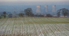
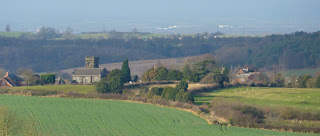
View from Fairview Farm, Foremarke
Here's a new walk which I have just written up. I have done it three times over the past 2 years and still enjoy it - especially in the fine crispy weather just before Christmas Day.
There are various other versions of this walk including one by peahen (see her blog right). She starts from the Reservoir Car Park but being someone who can't stand paying parking fees and also wanting a public transport link, I have started this near Coal Lane.
---------------------------------------------------------------------------

Start: SK334220
Route: Coal Lane – Foremarke Reservoir – Repton Shrubs – FairviewMilton Road – Foremarke Reservoir – Coal Lane
Distance: 8.3 km
Terrain: easy.
Park the car at the “lay by” at the junction with Coal Lane on the A514 near Hartshorne.
The Derby to Swadlincote bus also stops here. Cross the main road and take the restricted byway to Buildings Farm. After 200 metres you will find a gap in the fence on your right. (It’s the second gap in this fence).
Follow this path straight ahead (do not veer off to the left). The path dips down into a small valley descending to the left. Take the pronounced path in front of you which runs to the right of a small ride of trees that follow a stream. The path leads into a large open field. Look out for a gap in the opposite hedge. The track leads down to a foot bridge and boardwalk. (Carver Rocks is to your right and is worth an investigation). Follow the boardwalk to your right. Before long you will reach the south end of the reservoir and another bridge. Cross the bridge and follow some steps up hill through woodland.
Bottom of Foremarke reservoir
After 100 metres watch out for a path on your right that leads down to another foot bridge. From the bridge the path leads up to a notice board about Carver Rocks and a stile. The path leaves the wooded area and climbs almost straight ahead (slight left) to a stile at the top of the field. Here you meet a racing horse training track and pass through a small hinged gate. The path from here heads towards a small wood in front of you; aim to the right of it. You cross the race track again and follow a path with a wooden fence on your right. The fence separates you from the any race horses that might be training. After crossing a field you hit a metalled road where you turn right.
View towards Willington
Walk past the Bondwood farm drive on your right and a large communications pylon on your left until you reach a gate at the point where the track starts to descend towards Repton. Do not follow this route but take the track on your right. The views over the Trent Valley at this point can be quite splendid. Just before Fairview farm take the bridleway on your left, heading downhill towards the reservoir. The track descends very pleasantly through open country. After 800 metres it starts to sink and become tree lined. Soon you reach a metal farm gate and some properties on your left. On reaching the Ticknall to Milton road, turn right. There is now 1.2 kilometres of road walking but the road is generally not too busy and after 5 minutes you can walk on the wide verge on the left. Ignore the turn to the Burton Sailing Club. It’s the next main track on the right that you want.
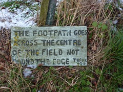
Sign near Brookdale sign
Enter the Reservoir area just beyond Bendalls Farm. To avoid the traffic you will find a path that runs parallel to the road on the left. The path soon reaches a wide gate which leads down the cycle path. Follow this very enjoyable undulating track for 2 kilometres. There are good views over the reservoir on your right.
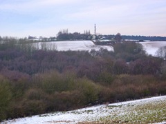
Looking back to Repton Shrubs
The track eventually meets a “T” junction where you turn left. Follow the road around to your right to a set of gates on the Ticknall to Hartshorne road where you will probably find some cars parked. You should see your car (or bus stop) from here on the left downhill several 300 metres ahead.

Monday 14 December 2009

Royal Label Factory


I spotted this makers' name on the footpath sign opposite the Sir Frances Burdett B and B on Derby Road (click to enlarge).

It seems that the company originated in Stratford upon Avon, then moved to Chipping Norton. It is now located just outside Buxton at Dove Holes!

It received its royal warrant in 1876 when it made metal plant labels for Queen Victoria.

The company is now owned by Leander Architectural (since 1998).

I found an interesting article here.

Saturday 12 December 2009

Curious signs on Melbourne FP6

Double FP signs

Melbourne FP6 runs from Cockshut Lane to Derby Road opposite the old Sir Frances Burdett PH.

It makes a useful short cut avoiding a sharp bend in the road.
You can link it with Breach Lane, Poppy Wood and the St. Brides Bridleway to make a return stroll to Melbourne.

Half way across is this curious double sign erected, I guess, in the 1960s when the local Parish Council asked for intermediate signing along the route. It is by the small footbridge.

When I walked it this week the middle section of the path was very wet due to a month of rain.

Beyond this sign the route can be unclear, you have to make for the white Frances Burdett building.

From Cockshut Lane
Looking towards the Sir Frances Burdett from Cockshut Lane (distant white building on left).


Friday 11 December 2009

Robin Wood - Misleading Sign


I was very confused by this new sign whilst walking around the wood yesterday as a bridleway goes straight through the middle of the wood and a footpath along one side.

I have spoken to Alan Dowell of the Forestry Commission today who has agreed that the sign is confusing. He is going to add a new section to the sign pointing out that the ROWs are still open.


The Ingleby/Stanton Bridleway is to the right of the sign!

Saturday 5 December 2009

Smisby to Hartshorne circular - new walk

Harthorne from Several Woods Farm

Above: Harsthorne Church from Several Woods Farm, Smisby.
This must be almost the highest point in the District.
Best seen large - click on photo.

Route: Smisby - Several Woods - Hartshorne - Limehouse Dam - Daniel Hayes - Forties Lane - Smisby.
Distance: about 8 km. Terrain is easy.
Transport: Regular bus through Hartshorne - so walk could start there.

This walk was quite a discovery because it is very rural yet close to both Ashby and Woodville. In places the drone of roads was completely absent, something that seems to be increasingly difficult to avoid in South Derbyshire. It's also a good walk, in my opinion, because there is a pub at either end!

I started off in Smisby and took the path by the church. The path runs around the back of the church and squeezes by a house on its left. The stile into a large field has no marker and for a moment I was disorientated. You need to turn left here and follow the field edge around the corner. You need to be walking parallel to Forties Lane after a couple of minutes. The path is OK in the first field but missing in the next. Cross Heath Lane and into a small thicket. Walk over a drive and then follow the path through a few fields. This was clearly marked. Everything is fine until you come close to Several Woods Farm where a marker seems to point you north when you need to go west around the edge of the farm complex.

If you have managed to circumnavigate the farm you'll come to a notice board. From here take the track downhill. This soon goes through a small wood past a pool. Take the main track north west for about a kilometre. You eventually emerge on Manchester Lane, turn right and you come to the Bulls Head where I had a very good pint of Pedigree (they don't sell crisps!).

Bulls Head Hartshorne

I wanted to look at the church so walked downhill to Church Street. After the church a path can be seen on your right, take this uphill past a couple of bungalows. The stile in the fence was missing, clamber over it and at the next stile turn left. The route is now straightforward as you pass around Limehouse Dam and make for Daniel Hayes. When you reach a turnstile gate turn right (though if you turn right you can still get back around to Smisby by a longer route). The path is now along a low escarpment until it enters Sharp's Bottom wood. This section is very well marked for South Derbyshire. Eventually the path climbs quite steeply, keep straight ahead ignoring a track on your left. At the top just before emerging from the wood you can turn left by a sign warning about race horses or go straight on.

I went left and passed by some uninspiring forestry plantings on my left. At the end of this section you need to make your way around a large shed on your left. I didn't, ending up walking through the Calke Abbey Racing Stables. Nobody seemed to bother. I should have come out opposite Forties Lane which I took back to Smisby.

About 3 hours, slow walking with a drink in Hartshorne.

Tuesday 1 December 2009

Coast access bill becomes law!


I have been away for a few weeks but on return was cheered by the fact that the Marine and Coastal Access Act has come into existence (12 November 2009).

I know that Melbourne is about as far from the sea as you can get but like many walkers coastal walking is one of my favourite activities when I get the opportunity.

I am looking forward to accessing some of those bits of coastline we haven't been able to get to before.

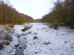
(Photo from Defra website)